
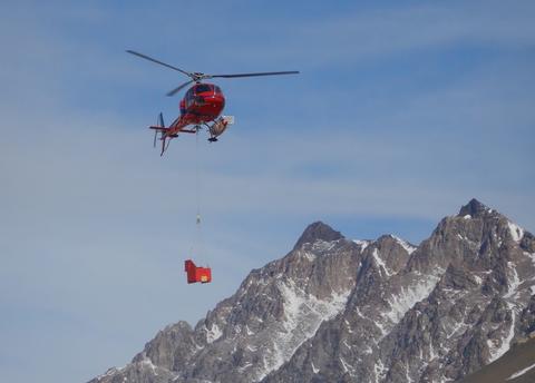
We are measuring the reflection of shortwave radiation across the MDV landscape to quantify how the reflectance evolves in a single season, and how it changes year to year. This spatially distributed measurement is a way of evaluating how 1) winter snow across the landscape disappears, 2) summer snow changes the interactions of soils, lake ice, and glacier ice with the atmosphere, and 3) how deposited sediment is affecting surface energy balance of ice surfaces. Data are collected from a sensor box that is slung under a helicopter and flown on a requested path along Taylor Valley (Fig. 1). Repeat measurements are made throughout the field season. These measurements contribute to testing all 4 of our working hypotheses, not as a direct test, but by informing our understanding of the effects of aeolian transport.
We hypothesized that albedo would decrease throughout the austral summer with ablation of snow patches and increasing sediment exposure on the glacier and lake surfaces. However, small snow events and ice whitening caused spatial and temporal variability of albedo across the entire landscape. We find that meteorological stations on the glacier frequently measure albedo near or above the highest helicopter-based albedo measurements. Spatial patterns of albedo are a function of landscape morphology trapping snow and sediment, and longitudinal gradients in snowfall magnitude and wind-driven snow redistribution from up- to down-valley.